Homepage
Twitter
Instagram
Email
NiteMode
DayMode
Biking Around Australia

Between February 2002 and March 2003 I circumnavigated 12,504 miles around the Australian continent on my bicycle, or push bike as they say there. After that I went to New Zealand for three months and met up with a friend and ended up pushing the total mileage to 14,115.7 miles (22717.02 km). I spent 269 days on my bike, 272 days not on my bike, and getting 67 flat tires over those 17 months.

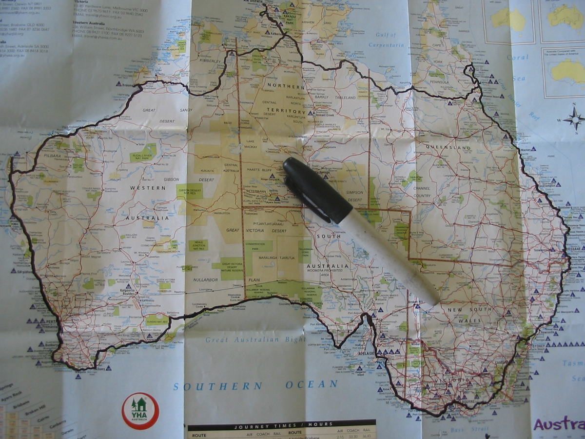
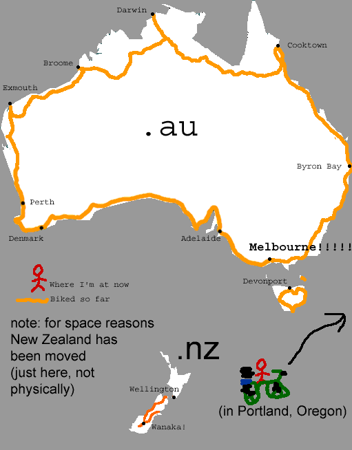
This is the route I took around Australia. Every few days I would update this YHA map with a marker and the route I more or less made up as I went along.
•••

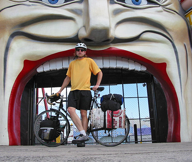
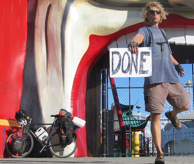
I started and ended my 13 month lap around Australia at Luna Park in St. Kilda/Melbourne.. The distance around Australia (including Tasmania) ended up being about 20,281km (12,600 miles).

February 12th, 2002 - 3:50pm
March 12th, 2003 - 3:12pm
•••
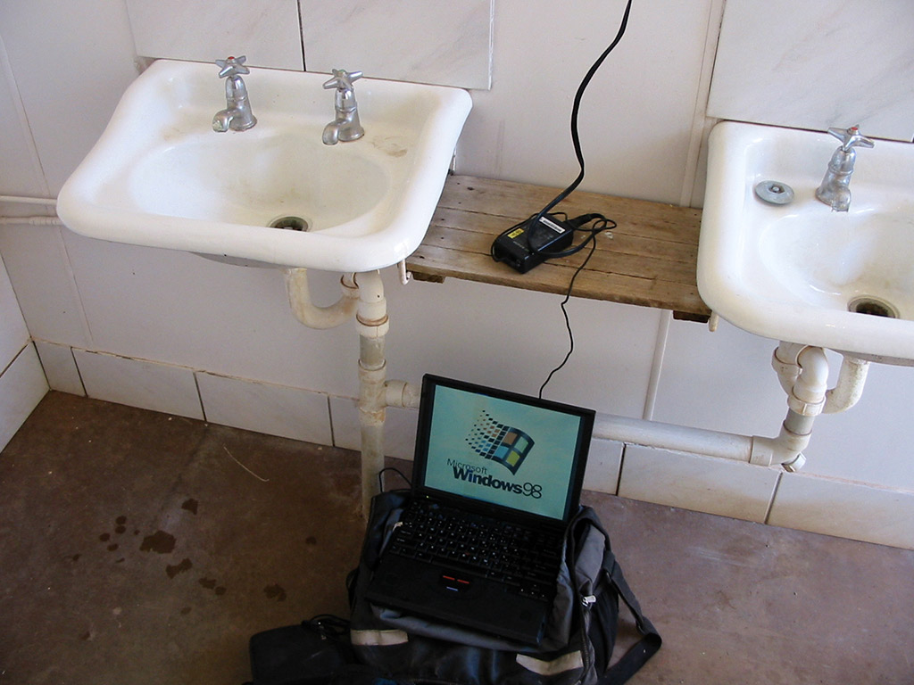
I carried a 15 pound IBM Thinkpad 600E with five batteries over the course of the entire trip in order to keep this website updated on a weekly basis so people back home could follow me on my travels. I had a system setup where I'd back the photos up to CDs and mail them home every few weeks. To update the site, I primarily did it with 3.5 inch floppy disks. There are 542 daily journal entries on here. I redid the website in 2020 so it would show up on phones and such ok. I took 36,304 photos over the 17 months and 12321 of them ended up here on this website. As for the words, there are 119527 of them for you to read. I didn't start active journaling until a couple months into the journey. I've noted where I've added journal entries way after the fact based on recollections or notes I had from the time. Some people have actually read the the entire site and have seen every picture. Some entries were written the same day, others were not. Some entires are a thought-provoking and a wholly entertaining read, others are downright boring.
Lunky.com website 2001-2020


The MS Paint image I updated every few days
•••
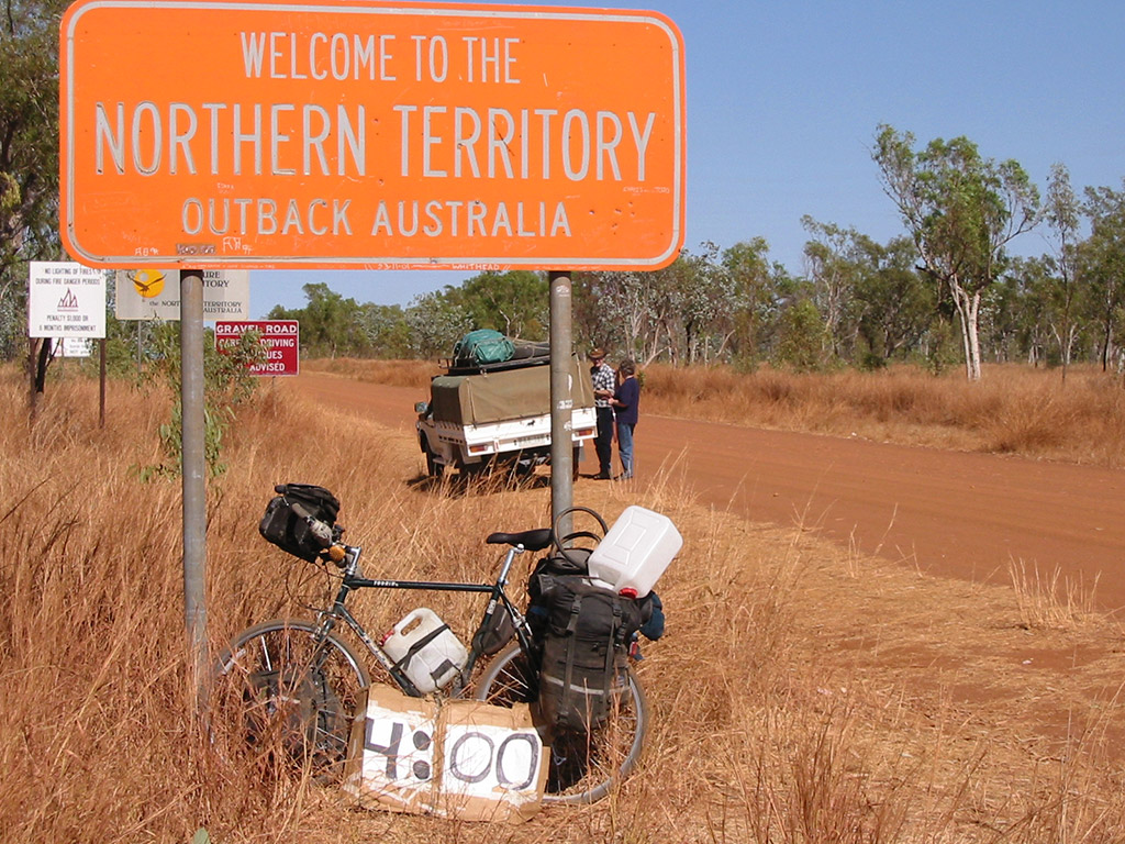
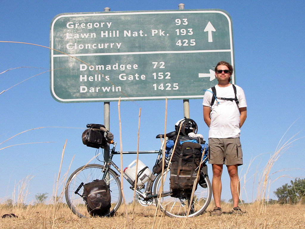
Also during the journey I carried a cardboard "clock" for this website I had started a year earlier called The Human Clock. Here it is on the Queensland/Northern Territory border
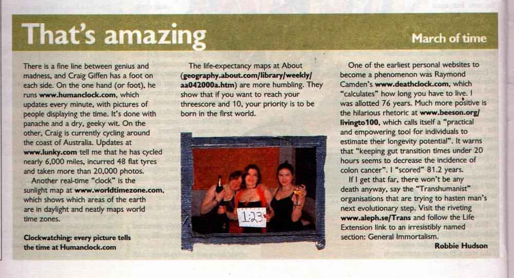
The Human Clock website was pretty popular then and it plus my bike trip got a quick blurb in the Sunday Times of London in September of 2002
•••

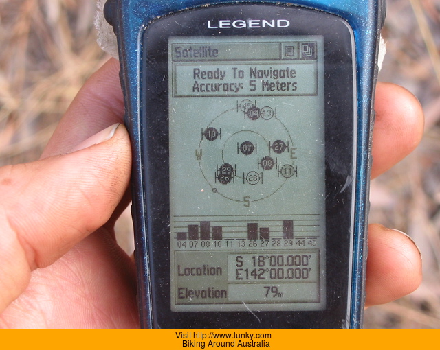
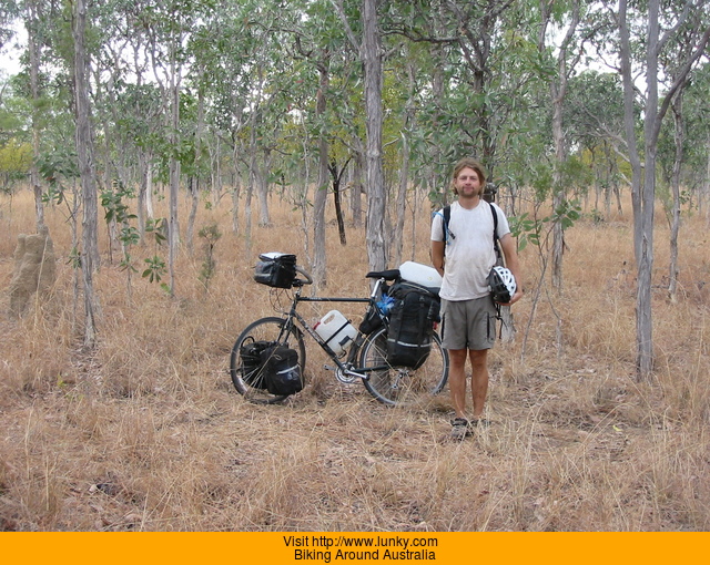
One fun thing I did during my trip was to visit six "confluences", which is where a whole-numbered latitude/longitude mark intersects for The Degree Confluence Project.

This was also back when the GPS looked nice
Standing at 18°S 142°E
Thanks for reading!
Craig
August 12th, 2002
day-192_yungabarra-to-somewhere-north-of-mt-garnet
QueenslandYungabarra to somewhere north of Mt. Garnet
80 km today
7432.13 km total
49.6 mi today
4607.6 mi total

Only biked about 80k today but it felt like about 150k. Hills, rough road, a visit to the doctor, two flats, and taking the wrong road.

Got up early and made breakfast, left soon afterwards. Did the take water/leave water thing in Yungabarra and headed out of town. Saw signs to a Fig tree but I didn't feel like biking the extra distance since I wanted to go into Atherton. Should have gone the other way however. Later found out about the Fig tree, it is this large tree with it's viny leaves hanging about 15m/45ft down to the ground.

Got into Atherton and found a small sporting goods store. Wanted to pick up an extra spare tire for the trip ahead. They actually had one in the size I wanted, but it doesn't look like it will hold up that long.

Decided to go to the doctor and see about my ear. Ended up having to go to three doctors offices to find one that would see me without me having to wait around all day. He said it was just congestion in my ear, not a biggie.

Headed out of town on made my way to Heberton. Right outside of town on a hill was a roadside memorial that looked like the accident had recently happened. A tree was missing its bark and was all gouged up. Beloe it were flowers, notes, and two high school rugby jerseys. It was pretty sad.

Got into Heberton and checked out the town little. Earlier in the day I saw a way that would get me to Mt. Garnet via gravel roads...a nice change from the sealed pavement and cars. I found the road and started down it. I soon passed what I thought might be the turnoff road I wanted, but it wasn't marked so I kept riding. About 4k and one hill drop later, I remembered I needed to check to see if that was the road I wanted or not. GPS showed that it was...dang. The way I was going would still get me there so I just continued on.

They say that if it ain't broke...don't fix it, meaning I should have just left my big tires on yesterday instead of changing them. Yesterday I changed into my skinny tires so I could wear them out and no longer be stuck with them. My rear tire wore out and exploded. After I got done fixing it, I noticed that the GPS decided to clear it's memory...there went yesterdays track...so no map for yesterday and half of today.

Got into Irvinebank around 4pm. Looks like it used to be a pretty significant town at one time, but not much was left except a lot of signs indicating what was there. Found the road I needed heading south and started down it. After passing between a couple properties with the most car parts per capita in the front yard. The road got really rough. I got a little nervous since I was all the way in this far and now had to deal with 40k of road like this. Turns out the first part of the road was also a creek drainage...so the road got better.

It was pretty nice riding through the forest on this dirt road. Nice until the road decided to climb 1000 feet...that wore me down pretty good. I eventually reached a junction that was not on the map. I went down the road that had a sign on it...about 2k down the road looking at the GPS and realizing that this was some sort of connecting road between the one I was on and the one I wanted to take a few hours earlier. I backtracked, then turned back around again and decided to just go down to the other road. Had a really hard time figuring out what I was going to do...that's when it helps to travel with someone...makes decicion making easier. Went down the road a bit in the dark w/ headlamp and found a spot to camp in the brush. Today will put me behind a little, but hopefully tomorrow I can get up earlier and make up the difference.

August 12th, 2002
80km
49.6mi